


Last updated: 5 October 2026 | Written by Pubudu Dissanayaka, founder of CeylonFarer
Table Of Content
- Colombo transport at a glance: the three lines that decide every trip
- Step 1: land, and choose the right way into the city
- If you land after dark
- If you arrive in the middle of the day
- Step 2: Colombo Fort railway station
- Step 3: ride the suburban railway
- How to buy a commuter ticket
- What we could not get from the operator
- Step 4: the Colombo bus routes
- Step 5: tuk-tuks and the missing meter
- Step 6: the apps and the decision table
- Colombo traffic tips for the peak
- The coast run: the Colombo to Negombo train
- Landing from Dubai: what the flight changes
- What we could not verify
- Frequently asked questions about getting around Colombo
- What is the best way to get around Colombo?
- Is the train or the bus better inside Colombo?
- How do you buy a ticket for a Colombo commuter train?
- Is there a tuk-tuk meter in Colombo?
- What should a tuk-tuk from Fort to Mount Lavinia cost?
- What are the main bus terminals in Colombo?
- What are the worst traffic hours in Colombo?
- How do you get from Katunayake airport to Colombo city?
- Do the ride apps work outside the Colombo district?
- Can you land from Dubai and reach the city the same evening?
- How this Colombo transport guide was put together
- Where to go next
Colombo is the one place in Sri Lanka where you can travel by train, bus, three-wheeler and app in the same afternoon, and the one place where guessing costs you an hour. This Colombo transport guide sets out the three corridors that decide every city trip, the fares that are published, the ones that are negotiated, and the measured times behind both. Everything below was read or measured on 5 October 2026, and where a number is our own arithmetic we say so.
One warning before the detail: the city is smaller than it feels from the traffic reports, and almost every surprise here is about time rather than money.
Colombo transport at a glance: the three lines that decide every trip
The city runs on three corridors, and a Colombo transport guide that ignores them ends up as a list of vehicles. The first corridor hugs the coast from Fort south through Kollupitiya, Bambalapitiya, Wellawatte and Dehiwala to Mount Lavinia and Moratuwa.
The second runs inland to the east through Maradana, Borella and Nugegoda towards Kottawa and Homagama. The third runs north to Kelaniya and Ragama, and from there to Gampaha and the airport. Almost every route a visitor needs sits on one of those three.
Free-flow driving times tell you how close the city really is. We routed 15 legs on the OpenStreetMap network with the OSRM engine on 5 October 2026, with no traffic model, so these are floors rather than forecasts. That distinction matters more in Colombo than almost anywhere else in this Colombo transport guide, because the peak-hour multiplier on the coastal road is larger than on any other corridor on the island.
| Leg from Colombo Fort | Road distance | Free-flow drive |
|---|---|---|
| Galle Face | 2.1 km | 3 min |
| Kollupitiya (Liberty) | 3.8 km | 7 min |
| Bambalapitiya | 5.8 km | 8 min |
| Wellawatte | 8.5 km | 12 min |
| Dehiwala | 10.6 km | 16 min |
| Mount Lavinia | 12.4 km | 18 min |
| Nugegoda | 10.3 km | 15 min |
| Kotte | 10.0 km | 14 min |
| Rajagiriya | 6.4 km | 9 min |
| Battaramulla | 10.3 km | 14 min |
| Kelaniya | 11.8 km | 16 min |
| Moratuwa | 20.6 km | 28 min |
| Negombo | 38.4 km | 38 min |
| Katunayake airport | 33.5 km | 30 min |
Step 1: land, and choose the right way into the city
Katunayake sits 33.5 km north of Fort by road. The first decision of any Colombo transport guide is whether you take the taxi counter, the train or the 187 bus into town. The airport’s own counter card is a destination tariff rather than a meter, and the expressway coach and the Katunayake line both cost a fraction of it. We set the three side by side in our airport transfer guide, and the counter card itself in our airport to Kandy piece.
If you land after dark
The train is the option people assume is still running at midnight, and it is not. The coastal road bus thins out too. A late arrival means the counter or an app, and the app is the cheaper of the two once you are inside the pickup zone. Keep a little cash, because some drivers cancel card trips at night.
If you arrive in the middle of the day
Daytime arrivals get the full menu, and the order is the same as everywhere else in this Colombo transport guide: rail first, bus second, road third. Give yourself an hour from the baggage hall to Fort, and more if you land between 16:00 and 19:30, when the expressway carries the evening peak back into the city.

Step 2: Colombo Fort railway station
Colombo Fort railway station is where the suburban network, the intercity network and the coastal road meet. The main line, the coast line, the Kelani Valley line and the Puttalam line all terminate inside it, and the platforms are two minutes’ walk from the Fort bus stands and the Pettah market. A Colombo transport guide should name it first for that reason alone. A traveller who understands Fort has understood the city.
Two things surprise people who arrive expecting a metro. First, there is no barrier and no turnstile: you buy a paper ticket at the counter and keep it for the exit, and nobody checks it on the way in. Second, the suburban and the intercity sides of the same station work on different rules, and mixing them up is the most common mistake we see at the counter.
Platform signs are in Sinhala, Tamil and English, and the announced names are close enough to the spelling that a visitor can follow them without a map. It is the one station a Colombo transport guide has to teach before anything else.
Step 3: ride the suburban railway
The railway is the fastest thing in this Colombo transport guide between 07:00 and 09:30, because it does not share the road with anything. The coast line runs at ground level the whole way south, so a train from Fort to Mount Lavinia covers the same 12 km as the car in a fraction of a peak-hour crawl.
Distances are the operator’s own, published station by station in the Station Details table of Sri Lanka Railways and read on 5 October 2026. Turned into the two corridors a visitor uses, they look like this.
| Coastal line, from Fort | Km | Kelani Valley line, from Fort | Km |
|---|---|---|---|
| Kompannavidiya (Slave Island) | 1.72 | Baseline Road | 3.78 |
| Kollupitiya | 3.11 | Narahenpita | 7.52 |
| Bambalapitiya | 5.13 | Kirulapone | 9.26 |
| Wellawatte | 7.25 | Nugegoda | 11.05 |
| Dehiwala | 9.96 | Maharagama | 16.36 |
| Mount Lavinia | 12.21 | Kottawa | 21.31 |
| Ratmalana | 14.01 | Homagama Hospital | 24.30 |
| Moratuwa | 18.95 | Avissawella | 61.18 |
| Panadura | 26.25 |
Two of the coastal stations are worth naming for a first visit. Kompannavidiya puts you beside Slave Island and the lake, and Bambalapitiya and Wellawatte put you inside the restaurant strip. A Colombo transport guide can list the stations, but only the ride tells you which one is nearest your hotel.
How to buy a commuter ticket
Two ways. The counter at Fort works for any station on the network and takes a couple of minutes. The state operator has also authorised its own e-ticketing platform, Pravesha, so a commuter ticket can be bought on a phone. The platform makes one rule explicit: an e-ticket issued for a commuter train is not valid on an intercity train.
If you are going to Kandy or Ella, that is a different product on a different system, and our train guide covers the reserved-seat route.
Fares are set by distance and class rather than by a single flat rate, so the same journey costs less in third class than in second, and the difference is small. Nobody in this Colombo transport guide pretends the suburban fare is worth optimising; the time saving is the point.
What we could not get from the operator
The railway’s own timetable page is a holding notice while a replacement is built, so the cleanest public departure list for suburban services is still the printed sheet at the station. We did not invent times to fill that gap, and no departure time appears anywhere in this Colombo transport guide.

Step 4: the Colombo bus routes
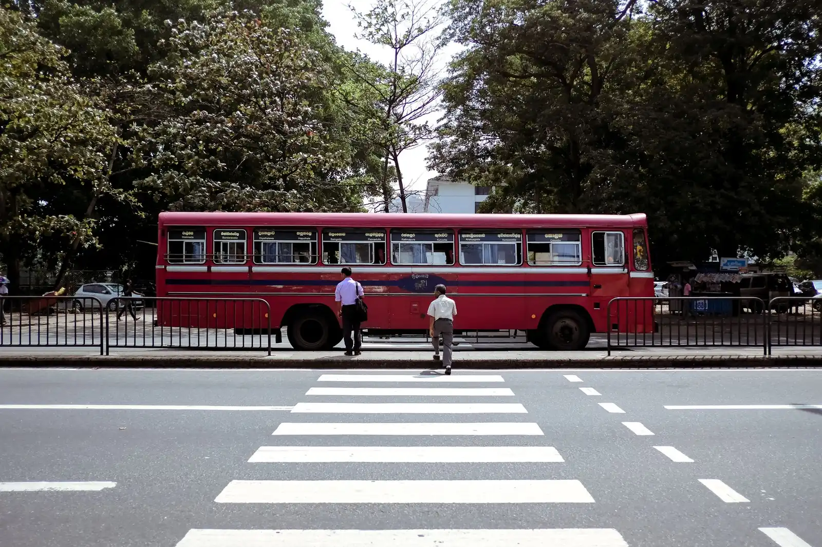
Colombo bus routes do the work the railway cannot, mostly on the inland axis and the outer suburbs. The National Transport Commission sets the fares, and its interim revision took effect on 6 July 2026. The normal, semi-luxury, luxury and expressway full fares are published as separate files on the commission’s own bus fares page. Fares are stage-based, so the price of a ride depends on how many stages you cross, not on a distance meter.
Four terminals matter to a visitor:
- Pettah and Bastian Mawatha, beside Fort, for the intercity and provincial routes that leave the city.
- Makumbura at Kottawa, the southern multimodal hub where the expressway buses and the city services meet.
- Kadawatha and Kelaniya, on the northern axis towards the airport road.
- Fort itself, where the short city services start rather than end.
Fares are paid to the conductor in cash and the ticket is printed, which is worth knowing before you board with a card in your hand. The state operator and the private operators run the same corridors, so two buses at the same stop can be the same route at the same price. For that reason this Colombo transport guide treats the bus as one network rather than two. Our bus guide covers the classes and the expressway network in detail; this Colombo transport guide only goes as far as the city.
Step 5: tuk-tuks and the missing meter
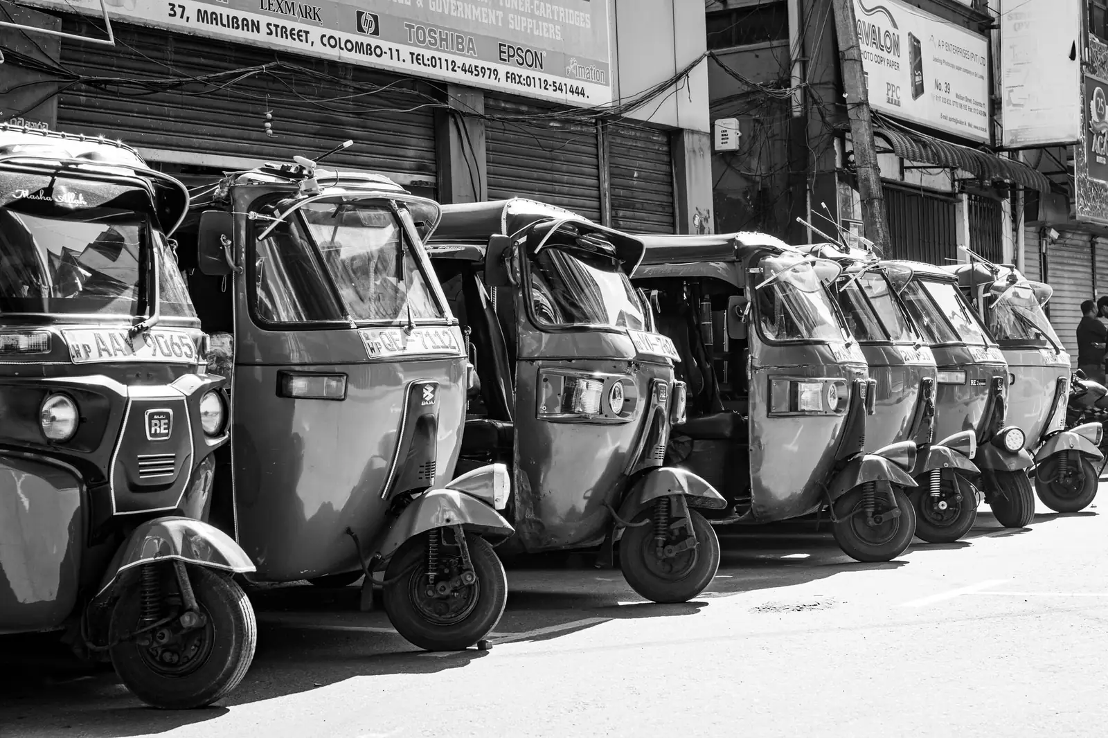
There is no meter in a Colombo three-wheeler in law, and anyone who tells you there is has one eye on the fare. The reference price is the gazetted Western Province scale, Rs 110 for the first kilometre plus Rs 90 for each kilometre after, in force since 24 March 2026. Applied to the distances we measured in the first table of this Colombo transport guide, a fair daytime fare looks like this.
| Run from Fort | Measured road distance | Scale fare (our arithmetic) |
|---|---|---|
| Galle Face | 2.1 km | about Rs 210 |
| Kollupitiya | 3.8 km | about Rs 360 |
| Nugegoda | 10.3 km | about Rs 950 |
| Mount Lavinia | 12.4 km | about Rs 1,140 |
| Negombo | 38.4 km | about Rs 3,480 |
Two practical rules follow. Agree the price before you get in. Expect the traffic to be the thing you are really paying for, because a trip that takes 18 minutes at 09:45 is not 18 minutes at 17:30.
That is the single most useful line in this Colombo transport guide. The licence, insurance and rental side of three-wheeler travel sits in our tuk-tuk guide.
Step 6: the apps and the decision table
The last mile in this Colombo transport guide belongs to the apps. PickMe is the local platform and covers far more of the island; Uber is deliberately smaller and lists only Beruwala, Colombo and Negombo. We compared the two in detail, including the airport rules and the payment quirks, in our ride app comparison.
With the fares, the distances and the apps on the table, the choice of mode stops being a matter of taste:
| Your trip | Take this | Why |
|---|---|---|
| Fort to Mount Lavinia or Moratuwa, 07:00-09:30 | Coastal line train | It ignores Galle Road entirely |
| Fort to Nugegoda, Maharagama or Kottawa | Kelani Valley line, or the Makumbura buses | The inland road is the worst of the three corridors |
| Fort to Kollupitiya or Bambalapitiya, off peak | Tuk-tuk or app | Short, cheap, and door to door |
| Fort to Galle Face | Walk, then anything | 2.1 km and flat |
| Fort to Negombo or the airport | Counter taxi or expressway coach | The rail line is slow and the bus is a long ride with luggage |
| A day of scattered stops | App, or a driver at a day rate | Repeated single trips add up faster than a day rate |

Colombo traffic tips for the peak
Colombo traffic tips usually stop at “avoid rush hour”, which is not an instruction. The measured gap in our own table is the instruction. A 12.4 km run to Mount Lavinia is 18 minutes free-flow. Every minute above that is the city’s congestion, and at the peak it is the largest part of the trip.
- 07:00-09:30 and 16:00-19:30 are the two peaks on all three corridors. Shift a sightseeing run by an hour either side and you save the most time of anything in this article.
- Galle Road is one-way-managed at points and turns left where you expect it to go straight. Watch the signs, not the map.
- The Fort and Pettah blocks are best crossed on foot. Getting a vehicle to loop back costs more time than the walk.
- School terms change everything after 13:00 on weekdays. If you cannot avoid a run, avoid that one.
- Rain stops the city in a way the timetable never mentions. A 20-minute downpour in May or October adds more time than the peak.
One more tip that no Colombo transport guide can time for you. The city empties on Poya days and fills again the next morning. A public holiday shifts the whole pattern by an hour in each direction.
The coast run: the Colombo to Negombo train
The Colombo to Negombo train is the one people miss. It leaves Fort on the Puttalam line, changes character at Ragama, and reaches Katunayake and Negombo on the operator’s own distances of 33.44 km and 38.85 km from Fort. That is almost exactly the 38.4 km we measured by road to Negombo. The train and the car cover the same ground, and on the coast road the train wins at the peak.
The catch is speed rather than distance. The Puttalam line is single track beyond Ragama with long gaps between services, and the airport station sits a short ride from the terminal rather than at it. Use it when your arrival window is generous and your bag is light. Otherwise, the transfer guide is the safer plan.
Landing from Dubai: what the flight changes
Dubai to Colombo flights land at Katunayake, 33.5 km north of Fort, and Gulf arrivals decide your first hour more than any other factor in this Colombo transport guide. A mid-evening landing still catches the expressway coach and the tail of the city buses. A post-midnight landing does not, and the counter or an app is the honest answer.
We did not re-check airline schedules for this piece, so we are not quoting flight numbers or departure times. What we can say is what the ground does. The taxi counter at the airport is a published destination card. The app pickup zone has its own rules.
The coastal road into Fort is the same road whether you land at noon or at three in the morning. If you are planning a car instead, car hire covers the rate cards.
What we could not verify
Three things stay open. The operator’s timetable page is under development, so we publish no suburban departure times. The railway fare table is distance and class based, and it is not published as a single English file. We give you the station distances instead, and leave you to read the fare at the counter.
The third is the flight side: we did not re-check airline schedules, so no flight number or departure time appears anywhere in this Colombo transport guide. Each of those is a gap rather than a guess, and each is the kind of gap a reader can close in a single phone call.
Frequently asked questions about getting around Colombo
-
What is the best way to get around Colombo?
For the coastal corridor the train is best, because it runs on its own track while Galle Road crawls. For short inner-city hops a tuk-tuk or an app is faster and cheaper. Buses cover the inland suburbs the railway does not reach. A Colombo transport guide that promises one answer is selling something.
-
Is the train or the bus better inside Colombo?
On the coast, the train. Fort to Mount Lavinia is 12.21 km of track against 12.4 km of road, and at peak the rail side of that comparison is the only one that moves. Inland, towards Nugegoda, Maharagama and Kottawa, the Kelani Valley line does the same job on a different corridor.
-
How do you buy a ticket for a Colombo commuter train?
Either at the counter, which takes a couple of minutes, or on Pravesha, the state operator’s own e-ticketing platform. Note the rule the platform states: a commuter e-ticket is not valid on an intercity train, so a Kandy or Ella seat is a separate purchase on a separate system.
-
Is there a tuk-tuk meter in Colombo?
No, not in law. The gazetted Western Province scale is Rs 110 for the first kilometre plus Rs 90 for each kilometre after, in force since 24 March 2026, and it is a reference rather than a meter. Agree the price before you get in, and treat the scale as the benchmark for a fair one.
-
What should a tuk-tuk from Fort to Mount Lavinia cost?
We measured the road at 12.4 km, and on the Western Province scale that is 110 plus 11.4 kilometres at 90, about Rs 1,140. Traffic is what moves the number: the same run is 18 minutes free-flow and can be an hour in the evening peak, so expect above the scale then.
-
What are the main bus terminals in Colombo?
Pettah and Bastian Mawatha beside Fort for provincial services, Makumbura at Kottawa for the southern expressway hub, and Kadawatha and Kelaniya on the northern axis. Short city services start at Fort itself. Fares are stage-based and set by the National Transport Commission, revised from 6 July 2026.
-
What are the worst traffic hours in Colombo?
Roughly 07:00 to 09:30 and 16:00 to 19:30, on all three corridors. The school run extends the afternoon peak past 13:00 on weekdays, and heavy rain adds time on top of both. Shifting a trip by an hour either side is the single biggest saving in this Colombo transport guide.
-
How do you get from Katunayake airport to Colombo city?
The airport is 33.5 km from Fort by road, and the choices are the taxi counter card, the expressway coach and the Katunayake line. The counter card is a destination tariff rather than a meter, so it is predictable but not cheap. The train and the coach are the low-cost options when your arrival window suits them.
-
Do the ride apps work outside the Colombo district?
Partly. PickMe covers far more of the island, while Uber lists only Beruwala, Colombo and Negombo on its own country page. Outside the main cities expect a slower match and a wider vehicle class. Our ride app comparison maps the coverage properly.
-
Can you land from Dubai and reach the city the same evening?
Yes, if you land while the buses and trains are still running, which a mid-evening arrival usually allows. After midnight the honest answer is the taxi counter or an app. The airport is 33.5 km north of Fort, so the road matters more than the mode at that hour.
How this Colombo transport guide was put together
Nothing above is an estimate dressed as a fact. Every distance, fare and operating rule in this Colombo transport guide has a source, and each was read or measured on 5 October 2026.
| Claim | Source | Checked |
|---|---|---|
| Station distances from Fort, by line | Sri Lanka Railways, Station Details | 5 Oct 2026 |
| Commuter e-tickets and the intercity exclusion | Pravesha (authorised by Sri Lanka Railways) | 5 Oct 2026 |
| Operator timetable page under development | Sri Lanka Railways, Train Schedule notice | 5 Oct 2026 |
| Bus fares and the 6 July 2026 revision | National Transport Commission, bus fares | 5 Oct 2026 |
| Road distances and free-flow times | Our own OSRM measurement, 15 legs | 5 Oct 2026 |
| Three-wheeler scale | Western Province scale, as published in our tuk-tuk guide | 5 Oct 2026 |
Where to go next
Start with the island picture in getting around Sri Lanka, which puts the city modes of this Colombo transport guide beside the long-distance ones. For the rail side, train travel goes further than the suburbs. For everything else, our guides index the rest of the site.



No Comment! Be the first one.